Hungarian version here
Borgo San Lorenzo
The friendly relationship between Várpalota and Borgo San Lorenzo is due to the sport. Every year we take part in their marathon running competition, and participants from the Italian city regularly come to the half marathon running competition, but also to our other events (Várexpo, Várpalota Days). The mayor, Giovanni Bettarini, expressed his intention, both orally and in writing, to establish a twinning relationship so that friendly relations could also become formal. Borgo San Lorenzo and Várpalota signed a twinning agreement on 19 August 2006.
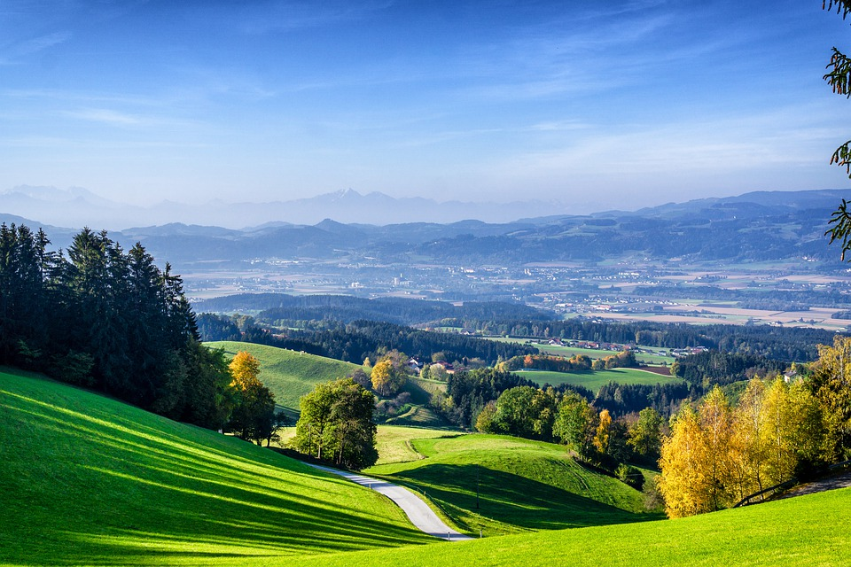
Borgo San Lorenzo is 35 km north of Florence. Its founding dates back to the Roman Empire. Due to its favorable geographical location, the city has become an important commercial center of the countryside. It is currently famous for its high quality agricultural products. An agricultural fair is held in June each year. This indicates the importance of the sector. In addition, the Chini manufactory is significant, the products of the majolica factory are world famous.
More information:
http://it.wikipedia.org/wiki/Borgo_San_Lorenzo
http://en.wikipedia.org/wiki/Borgo_San_Lorenzo
http://www.comune.borgo-san-lorenzo.fi.it
http://toscana.indettaglio.it
http://www.aboutmugello.com/borgo-san-lorenzo.html
Körmöcbánya (Kremnica)
How did the town twinning relationship begin?
How did the two cities find each other? The beginning of the relationship dates back well to socialist times. The management of the Várpalota Miner’s Sports Club noticed the friendly relations between the socialist countries in various fields and Iván Csiky has been assigned to select the foreign partner. The common point was mining, so a letter of contact was sent to three mining towns: Besztercebánya (Banská Bystrica), Körmöcbánya (Kremnica) and Selmecbánya (Banská Štiavnica). A reply letter was received from only one place, the Miners' Training Association of Körmöcbánya (Kremnica). On July 1, 1956, the delegation was formed by athletes, official leaders, and leading workers. Later, cultural and sports meetings were regular. Visitors from Várpalota were enriched by many friendly relations. Between 3 and 8 October 1966, a large delegation arrived in our town at the invitation of the Várpalota City Council. They visited the city's factories and council institutions. During the visit, on October 7, 1966, the twinning contract was concluded. In the decree we read about the efforts "to work even closer together for the sublime idea of friendship and lasting peace between the two peoples." The co-operation agreement was signed by the János Kiss Urban Committee President. After the regime change, the connection was almost completely severed. In 1996, Tibor Leszkovszki, the mayor of Várpalota, sent an invitation to the mayor of Körmöcbánya (Kremnica) to the Várpalota Days in October to renew twinning relations. As part of a series of events in the XIII. Várpalota Days, the twinning agreement was signed on October 10, 1998, with the aim of strengthening the friendly relationship, renewing the cooperation and moving it on a new foundation.
Presentation of the city
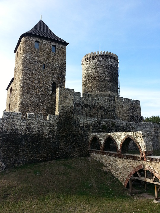
Körmöcbánya (Kremnica) is located in the western part of Slovakia, 253 km from Várpalota. Turning from the main road connecting Pozsony (Bratislava) and Kassa (Kosice) through Garamszentkereszt (Žiar nad Hronom) to Turócszentmárton (Martin), the town is only 14 km away, which is well known as a mining town. In the 14th century, after its gold mining as part of Hungary, the town was named the Arany Körmöcbánya (Gold Kremnica). The most dominant and at the same time the oldest part of the city is the castle with the church of St. Catherine.
Population: 5883 people
Area: 4313.3 ha
Lowest point: 55 m above sea level
Highest point: 1232 m above sea level
History of the settlement
The area around the river Garam was an inhabited area for 2,500 years. The first mining settlers arrived in the mountains around the river in the 10th century. Firstly the gold was mined from the streams by gold washing and then by surface mining. In the XIII. century, more German settlers arrived and restarted mining. Körmöcbánya (Kremnica) lived its golden age in the XIV-XV. century, during the reign of Charles Robert of the House of Anjou. In 1328, the king inaugurated a mining settlement called Cremnychbana as a city and founded the mint. The original of this important document can be found in the Museum of Money and Medals, which also proves that the settlement received several privileges. At this time the mines were produced approx. 400 kg of gold annually. From the 16th century, mining began to decline, and the headquarters of the Mining Chamber moved to Banská Štiavnica. In the 1970s the gold mining was finally gone. Geological research shows that the mountains of Körmöc still hide this treasure, but this is not enough for mining to resume.
Natural conditions
The Körmöc mountains form a geomorphological unit of volcanic origin as part of the Western Carpathians. In terms of its geological composition, it consists of volcanic rocks, mainly andesite and rhyolite. In the past, diggings were here. Its surface is articulated, alternating with frequent hills and valleys. 70% of the area is covered by forest, the most typical of which are oak and pine forests, among which other tree species are mixed. The stone seas of the ridge are morphologically interesting. These are the remains of broken lava, shaped by time and nature into bizarre shapes. The highest point of the Kremnica Mountains is the Flochova peak (1316.9 m), which is covered with forest, so the view is only partial. From the ground - 900 m deep - thermal water flows, with which the city operates a thermal beach.
Sights, places of interest
The Main Square is the center of city life. The XIV. century civic houses have been rebuilt several times in the meantime. In the middle of the square stood a church, which was demolished at the end of the last century due to static defects. The baroque fountain and the baroque-style plague memorial column have survived. Major buildings in the main square include the Franciscan monastery with its church and chapel, the Museum of Money and Medals, the Town Hall, the Mint and the gate of the main square. The gate and the city wall were built in the 15th century.
The Mint was originally built in the Corner Valley north of the Main Square, in which a silver garage was minted in 1329 and a gold ducat and silver penny in 1335. The facade of the building dates back to the 19th century. it was rebuilt in the first half of the 19th century. It is a unique architectural specialty in Europe because it has been operating continuously since its foundation. When the city was in danger during the Turkish occupation, the mint was relocated inside the castle walls. Kremnica Castle is a building complex of medieval buildings built between the XIII.and the XV. century. A typical building is the Church of St. Catherine, with a lookout tower. The church is surrounded by several bastions and towers. The original mining houses still stand in several parts of the city. With their idyllic simplicity, they beautify the city and symbolize part of its history.
The Skalka ski resort is located in the center of the Kremnica Mountains. In winter it offers an excellent opportunity for sports: five ski lifts operate, two of them with night lighting. In addition, there is a 15 km long standard cross-country ski track and a 42 km long run in the winter. (Source: http://www.varpalota.hu)
More information:
http://www.kremnica.sk/hu/ (Official website of Körmöcbánya - in Hungarian)
http://hu.wikipedia.org (Wikipedia - Körmöcbánya entry)
http://kremnica.duskova.sk/ (Virtual city of Körmöcbánya - in English)
Petrozsény (Petrosani)
The twinning relationship was established
On behalf of the Democratic Association of Hungarians in Romania in Petrozsény (Petrosani), Vice President István Hegedűs initiated the establishment of relations between the two cities in January 1998. Várpalota was chosen because, like Petrozsény (Petrosani), it has a significant mining tradition. The Board of Representatives discussed the initiative on February 26 this year and authorized Mayor Tibor Leszkovszki to make official contacts with the city of Petrozsény (Petrosani). From 11 to 14 June, the City Council of Petrozsény (Petrosani) invited a delegation of the Municipality of Várpalota and the city's art ensembles to perform at the Petrozsény (Petrosani) International Folk Dance Festival.
Fulfilling the invitation, more than 30 children and 5 more adults started to Petrozsény (Petrosani), led by Deputy Mayor Károly Törzsök. The revisit and the signing of the agreement took place on August 20, 1998 by Tibor Leszkovszki and Carol Schreter at the Gyula Nagy Gallery. The cooperation aims to help the intellectual, cultural and economic growth of the two cities by involving the citizens, institutions, art groups, churches, business organizations and owners of small business the two settlements. Carol Schreter, Mayor of Petrozsény (Petrosani), was awarded the title of Honorary Citizen of the Town of Várpalota in 2002 for his enthusiastic support for cooperation between the two cities.
Petrozsény (Petrosani) is geographically located in Hunyad (Hunedoara) County, in the eastern part of the Zsil Basin. The area of the town with the county status is 19,556 ha, of which only 930 ha can be inhabited. Its population is approx. 45,194 people, the population of the whole Zsil Valley is approx. 170,000 people. Elevation: 610m The city is located 85 km from the county center, Deva and 350 km from the capital of Romania, Bucharest. It is easily accessible by rail and country. It is 604 km from Várpalota.
Historical past
The area has been inhabited since ancient times, as evidenced by recent excavations and finds in Jieţ and Popi, as well as in the Bolii Cave. The name of the river Zsil (Jiu) was left as a legacy by the Ghettos. The river also gives the name of the whole region. The inhabitants of the small settlements were engaged in animal husbandry, hunting and agriculture. The first written record of the countryside dates back to the XV. century, 1493. This year, the King of Bohemia and Hungary donated two settlements from Zsilvölgy to Baron Mihály Kendeffy (Cânde) in Hátszeg as a reward for his bravery in the battles against the Turks. From then on and mainly in the XVI - XVII. century, the basin became more and more populated, and Petrozsény (Petrosani) village was founded at the beginning of the XIX. century with 233 inhabitants. At this time, the population of the Zsil Valley was approx. 2550 people. The construction of the railway line and the industrial extraction of coal brought about the rapid development of the city and the whole countryside. In a few decades, the image of the city has changed radically and, along with the countryside, has become the most important mining center in the country. It was declared a city in 1924 and had a population of 15,405 at the time. In 1968 it became a county town. Its population at that time was 31,248.
Natural conditions
The surface shapes surrounding the city are very diverse. The riverside terraces are replaced by hills, mountain pastures, then high mountains and alpine peaks. The city is surrounded by hills and high mountains. The mountains surrounding the basin are: the Parâng Mountains with a peak of 2518 m to the Great Parâng to the east, the Retyezát Mountains with a peak of 2482 m to the west, the Surianu Mountains with a peak of 2059 m of the same name to the north and the Vulcan Mountains to the south with a peak of 1868 m. The climate is cool and the humidity is very high. Winter is always long and the blanket of snow provides pleasure for funs of winter sports for 5-6 months. Its flora and fauna are rich. Here you can find typical representatives of the hills and alpine life: oak, beech, pine, bear, deer, wild boar, trout.
Economy, culture
Economically, the city relied on the mining industry, as well as on mining plants and economic units. The headquarters of the Mining Trust is in Petrozsén (Petrosani), from where it controls the activities of 13 mining companies and 3 coal washing companies. The city had 2 mining companies, of which only one now operates. Other plants in the city include two mining machinery manufacturing and repair companies, a wood processing company, a textile company, and a mining rescue station, a mining safety research institute, and a mining design institute. In the last 30 years, the city has developed a lot in terms of spatial planning and construction. The creation of the Airport and the North Petrozsény (Petrosani) districts provided places to live for about 20,000 inhabitants. The purchasing opportunities of the city residents are provided by approx. 1,600 private and public trading companies.
The city's water supply network has developed, with a length of more than 70 km and a length of sewage and drainage channels of 59 km. The length of the upgraded roads is 84 km. The city has a long tradition of cultural life. There is a House of Culture in the town and a theatre named after a writer from Petrozsény (Petrosani) I.D. Sârbu. It has been operating since 1948. The city also has a music school, whose students have received numerous awards and recognitions at national and international festivals. The beginnings and development of mining are presented The Mining Museum. It was founded in 1920 and presents the history and development of mining. Additional institutions: 50,000 volume library, 1 daily newspaper, 5 weekly newspapers, 3 radio stations and 2 local TV stations. A significant representative of the sports life is the Jiul Sports Club, whose football team was founded 81 years ago. And the Universitatea Sports Club and several departments of the Sports School are educating the athletes of the future.
Tourism
The extraordinary natural conditions of the region provide an opportunity for the development of tourism. From the city, several routes lead to the tourist zones of the area, which provide many entertainment opportunities for visitors in summer and winter.
The main tourist zones near the city are:
a) Parâng Mountains and its most important sights: the Great Parâng Peak 2518 m, the Cârja Peak 2404 m, the Gâlcescu Glacier (1921 m). Here you will find a chairlift, ski slopes with cable cars and mountain hotels.
b) Retezat Mountains - this is the largest nature conservation unit in Romania, the Retezat / Retezat National Park. There are nearly 80 glacier lakes in this nature park. In addition, Lake Zanoaga in 1973 m, Lake Galesul in 1990 m and many other lakes complement the wildly romantic landscape. A variety of mountain hotels await tourists: Cheile Butii at an altitude of 1039 m, Buta at an altitude of 1250 m, Pietrele at an altitude of 1400 m. (Source: http://www.varpalota.hu)
More information:
http://www.petrosani.ro/ (Official website of Petrozsény)
http://petrozseny.lap.hu/ (Petrozseny.lap.hu)
http://petrozseny.adatbank.transindex.ro/ (Transindex - Transylvanian net catalog)
Wolfsberg (Volšperk)
The beginning of the twinning relationship
It has been in contact with the Austrian city of Wolfsberg (Volšperk) since 1988 as a result of a lucky car accident. The case was personal and also required various organizational connections. The twinning relationship extends to education, culture and sport. The draft twinning agreement had already emerged around 1997, but the decree was not signed until June 1999 in Wolfsberg. In Várpalota on 20 August of the same year, the document was ceremonially signed in the Culture Centre of Good Luck in connection with the statehood celebration. Under the agreement, the governing bodies of the two cities express their intention to formally assist each other in friendly, cultural, sporting and economic relations. The cooperation serves the intellectual, cultural and economic growth of the two cities. It can also be useful for the citizens, institutions, art groups, churches, business organizations, and individual entrepreneurs of the two settlements. Three of the people involved in strengthening relations between the Várpalota and Wolfsberg have already been awarded the title of Honorary Citizen of the Town of Várpalota: Klaus Berchtold, Herbert Eile and Alexander Burda.
Wolfsberg (Volšperk) in the light of facts and figures
The city, located between Kor and Saualpe in the middle of the Lavant Valley, has been an important commercial hub and interchange since the Middle Ages. Population: 25,369 main area: 278.40 km² altitude: 461m, it is located 360 km from Várpalota. Many commercial and industrial plants are based in Wolfsberg (Volšperk). In many cases, these are also known outside the region. In addition, the importance of tourism is growing. Wolfsberg (Volšperk) famous for its excellent gastronomy as well as hotel and hospitality, and 142 accommodation establishments offer a total of 2,000 guest beds. Many cultural, sports and leisure opportunities complement the diverse offerings of the center of the area. The town of Wolfsberg is the political, economic and cultural center of the Lavant Valley in Carinthia, also known as the Carinthian paradise. The settlement is first mentioned in a 12th century document. The city has a varied history, which is reflected in its many sights.
Town twinning
The town of Wolfsberg (Volšperk) is historically closely linked to the Franconian province. From the XI to the XVIII. Until the 16th century, much of the central and upper Lavant Valley belonged to the large Carinthian seat of the Bishopric of Bamberg. In 1759 an important chapter of this story was closed because the imperial house acquired the goods of Bamberg. In the sixties, they contacted the Frankish region again. At that time, the mayor of Bamberg, Dr. Mathieu, invited every Carinthian city that once belonged to the bishopric of Bamberg. The twinning between Wolfsberg and Herzogenaurach was formally established in 1968 and has been intensive since then.
Leisure
The Wolfsberg (Volšperk) district is without a doubt one of the most favorable parts of southern Austria. There is hardly a place elsewhere where the number of hours of sunshine is so high. The 960 km2 area is bordered by the Lavant Valley, which has been a "Carinthian paradise" since ancient times. It is surrounded by the Kor and Saualpe mountain ranges, bounded on the north by the Obdachel Sattel, on the south by the Drava. The valley is north-south. The valley owes its name to the river Lavant, which originates on the southeastern side of the Styrian Zirbitz mountain peak. There rests the deep and dark Lavant Lake, from which it emerges as an invisible stream and moves towards the valley. It flows in front of old towns, markets, churches, castles and chateaux, modern industrial and bridge-building factories. It crosses the valley for 60 km and finally flows into the vast Drava at Lavamünd. Tourism has been very important in this beautiful region of Carinthia for decades. Wolfsberg is a well-known leisure center across the country. In summer, the natural environment, the bustling life of the city, and many sights are the focus of interest. In winter, the magnificent ski resort invites you to healthy sports activities at Koralpe. The hospitality of the nation is famous, by which we mean homeliness and striving for well-being. In small village inns, sunny gardens, cozy mountain hotels, the bustling city center, cafes and shops, the guest is all king. Wolfsberg has an interesting and varied nightlife, consisting of popular night spots and discos. (Source: http://www.varpalota.hu)
More information:
http://www.wolfsberg.at
https://en.wikipedia.org/wiki/Wolfsberg
https://de.wikipedia.org/wiki/Wolfsberg
Fermo
It is the seat of the Italian province of Marche and the county of Fermo. Its population in 2018 was 37,238. It is set at 319 above sea level.
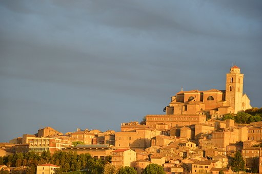
The city, which serves as the archbishop's seat, is located on a hill, close to the sea, overlooking the river Tenna. The city and its surroundings abound in natural beauties and ancient historical monuments. It is worth visiting the city, as well as the whole county - and in it the other sister cities of Várpalota, or exploring as yet unknown towns and villages in this beautiful countryside. The coast offers sandy and pebbly beaches for bathing. Fruit growing is significant in the area, and the carefully cultivated small farms offer a special spectacle on the soft-arched hills.
Connection with Várpalota
The city of Fermo was introduced to the Várexpo at Várpalota in 2000, when it joined the other small towns in the Marche province. The Várpalota micro-region then established a long-term international cooperation in which the regions of four countries participated. The micro-region of Várpalota was joined with the Lavant Valley from Austria, the Koroska region from Slovenia and the Marche region from Italy. The topics of professional cooperation included environmental protection, and various language learning programs, art courses, and a joint traveling exhibition of fine arts were organized.
The history of the city
Its territory was already inhabited in the Iron Age. B.C. In 264, the present city is already listed as Firmum Picenum. The settlement formed from the Roman colony i.e. By 90, it had risen to the rank of a city. It was a city with extensive autonomy under Roman rule. It was ravaged by barbarians in the 5th century. In 825, Lothar I founded the predecessor of today's university. Marca Fermana (Brand of Fermó) became its seat, bordered on the north by the Musone and on the south by the river Pescara. In 1199, Fermo declared itself a free city.
In 1242 II. It was occupied by Emperor Frederick, at which time the huge fortress, Rocca di Girfalco, was built and destroyed in 1445. In 1589, Pope Sistine V elevated the city to the seat of the archbishop, and the cathedral to the rank of Basilica Minora. In 1797, Fermo became the seat of the province of Tronto.
Under Napoleon, in 1808, Fermo prefectural seat. With the return of the city to the papal state, Fermo became and remained the county seat until 1860, when the Sardinian-Piedmontese took over. The province of Fermo was then administratively abolished until 2009. Since 2004, the city has been the capital of the province of Fermo.
It boasts monuments such as the famous cistern and the finds of the Archaeological Museum. The first traces of Christianity have been preserved by the remains of the former basilica below the cathedral. The direct consequence of the trade agreements concluded with Venice in the Middle Ages was the construction of the port belonging to Fermo, the great economic and cultural development. The Comune del Popolo and the Capitani del Popolo are located in Popolo Square from this period. Today, the city gallery is located in this square. During this period, the construction of the Gothic cathedral and the St. Augustine Oratorio were completed. The oldest part of the famous library created in Palazzo Priori was 350,000 volumes. Next to this historic library room is the Globe Room. In 1782, Maroncelli created a faithful miniature of the Earth and it is the great pride of Fermo.
Attractions
Piazza del Popolo: a wide, spacious square lined with proportional columns of historic buildings
Loggiato San Rocco
Biblioteca Comunale
Palazzo dei Priori: medieval Renaissance palace in the city centre. Home to art and archaeological museums
Pinacoteca
Piazzale del Girfalco
Cathedral
Palazzo Azzolino and Palazzo Vitali Rosati
Church of San Francesco: it has an iconic green dome and a pointed tower
Villa Vitali
Roman cistern
Church of San Zenone
Dioccesano Museum
Church of Sant'Agostino (Torre di Palme)
Church of Santa Maria a Mare (Torre di Palme)
hurch of Santa Maria (Capodarco)
Holidays, events:
Local Products Festival (March)
Antiques and Crafts Fair (Thursday, July and August)
Palio dell'Assunta (August 15)
International Amateur Cycling Competition (August 16)
Famous citizen:
Galeazzo Maria Sforza (1444 – 1476) Later Duke of Milan
More information:
https://bkb.hu/palotanet/index.php
https://en.wikipedia.org/wiki/Fermo
https://hu.wikipedia.org/wiki/Fermo
https://www.tripadvisor.co.hu
https://www.italythisway.com
Sant’Elpidio a Mare
Várpalota also maintains twinning relations with several small Italian towns in the province of Marche. Sant’Elpidio a Mare is also located here.
The beginning of the relationship
Alessio Terrenzi Mayor of Sant’Elpidio a Mare and Márta Campanari - Talabér Mayor Woman of Várpalota - signed the twinning agreement in April 2017, during the Italian Days at Várpalota - after several years of preparation. In the year before ( in 2016), the contract was signed in Italy on the occasion of the Hungarian Days in Sant'Elpidio. Athletes from the two settlements and their surroundings have been participating in each other's running competitions for a long time - this is where the contact started. The two cities involve more and more organizations, civilians and city dwellers in the program through friendly and formal meetings, competitions and joint cultural events.
Presentation of the city
The small town of Fermo county is located on the ridge of the Marche Appenine mountain range between the Tenna and Ete Morto river valleys. The Adriatic coast is only 9 km away. It has a population of more than 17,000 (2018 data). Searching the internet, we can hardly find any information about this picturesque settlement. The old houses of the charming old town are spectacularly arranged in a semicircular area. The 1-2-storey stone houses are separated by narrow streets typical of Mediterranean town.
History of the city
Its history dates back to the 8th century. Archaeological excavations have uncovered Etruscan burial sites. In its place in ancient times stood a town called Cluana, which was destroyed by the Goths in the 5th century. A large Benedictine abbey was founded here in 887, and around this the medieval city center was built in the 11th century - under the name Castello di Sant'Elpidio. And the renaissance maps indicate a small seaside fishing village on the town’s Porto Sant’Elpidio site.
Main attractions
In the center of the town you will find the far-looking tower of the Torre Gerosoliminata (Tower of the Knights of Jerusalem) with a beautiful view of the surroundings: the Sibillini Mountains, the city of Fermo, the Adriatic coast. It was built in the 19th century by the Knights Hospitaller.
The Benedictine Abbey (Imperial Abbey of Santa Croche al Chienti) was built on a pre-existing religious center and lived its heyday dating back to the XI – XII. century, when it was expanded and rebuilt in the Romanian style.
XIII. and XIV. century city walls - 3 km long. Today we can only see 3 of the original 7 gates.
More significant buildings
XIV. Century City Hall
Church of the Madonna dei Lumi
Sant'Elpidio Abate Church
Sanctuary of the Madonna degli Angeli
On the nearby coast, the coastal town of Porto Sant’Elpidio attracts more tourists every year with its imposing cliffs and palm-lined promenades - about 8 km long.
More information:
Sant'Elpidio a Mare - Wikipedia
https://www.tripadvisor.com
Porto Sant'Elpidio / Italy (Adriatic Info.eu - Adriatic Sea and surroundings)
Grottazzolina
This small town is also located in Fermo, Marche region, which joined the twinning program of Várpalota in 2013. It has a population of 3,333 (January 1, 2018). It is 227 m above sea level and is located halfway between the Adriatic Sea and the Sibillini Mountains. Like other small towns in the region, Grottazzolina is characterized by the food and handicraft industries: artistic ceramics, terracotta floor tiles, glassware and picture frames. The artistic processing of pearls and the shoe industry have a long history. Animal husbandry and meat processing are also important.
Town twinning
The twinning agreement was signed by the mayors of the cities - Mariano Ambrogi and Márta Talabér - in 2013, at the Várpalota Days in September. In reality, the relationship has worked for several years, both in sports and through various cultural events. In 2019, Mariano Ambrogi won the award of honorary citizen in our city as a recognition of his successful work for Italian-Hungarian micro-regional cooperation. In addition, tender experts from the two cities have already worked together on a joint EU environmental project. At a meeting in Italy, topical environmental challenges from the perspective of small towns were discussed. In addition to serious work, they also strengthened friendly relations with joint folk dance and gastronomic events.
History of the city
The first human settlement in the area of Grottazzolina was established in the 8th century BC. Around the middle of the 10th century, the monks of "Farfensi" built the castle, which became the center of the settlement. Later, as a result of a quarrel with Fermo, the castle of Grottazzolina was occupied and looted several times: As a result of peace talks in the Senate of Fermo, Prince Uffreducci strengthened the city. To end the constant strife over the city, Roman Judicial Chiefs were appointed, but they too always handed down the verdict supporting Fermo. It became part of the Italian Republic in 1860, when II. Viktor Emánuel possessed it from Fermo, and at that time he was proclaimed an independent city.
Sightseeing
The church of John the Baptist (1768) is a national monument, built on the foundation of a Roman church. The altarpiece from 1694 depicts the baptism of Christ.
The Church of the Altar Sacrament was built in 1768 and has a classical façade. Its main ornament is the Asti Golden Cross was made in the 16th century.
Inside the Azzolino Castle stands the 17th century St. Monica's Church.
The Ermete Novelli Theater dates back to the 20th century. It was built in the Art Nouveau style and can accommodate 200 people.
The Town Hall , 20th century early building . Its medieval - atmosphere pecked tower offers an uplifting view.
Events (every year)
The Feast of the Madonna - “whose help will not cease in the life of the city” - is a series of events at the end of the first week of June each year in Grottazzolina.
Feast of St. Anthony - inthe month of January,
the Royal Carnival - in February,
the Beer Festival - in July,
the Piceno marathon - in September,
the International Photo Contest - will be held in November.
More information:
https://hu.wikipedia.org/wiki/Grottazzolina
https://bkb.hu/palotanet/
https://en.wikipedia.org/wiki/Grottazzolina
https://www.tripadvisor.co.hu/
https://www.comune.grottazzolina.ap.it/it
Porto San Giorgio
Porto San Giorgio is a seaside settlement of Marche region in Italy. Number of inhabitants is about 16 000. It is a popular holiday resort. There are excellent beaches, for example Coba Beach and Lido Bandos.
Presentation and history of the city
Castellum Firmanorum - in the writings of classical Roman poets, we can read about this settlement on the site of today's Porto San Giorgio and also Strabo mentioned it as Castrum firmanorum (in Tabula Peutingeriana). The creation of the seaside town is due to the port and its connection with Fermo. For centuries, Fermo has been the port of Porto San Giorgio for access to the sea. It is also connected to Fermo by road, rail and the river Ete.
Porto San Giorgio is a city connected to the sea, with close links to tourism, fishing, trade, health resorts, resorts and tourist centers. Porto San Giorgio is closed to the south by the tourist and fishing port. The harbour and the boat mooring were opened in 1980, and it has about 1,000 berths. In addition to the tourist area, the city also has a professional fishing fleet.
As the city's main economic source is tourism, visitors can choose from several programs: concert events to suit everyone’s tastes, an open-air cinema festival. The Feast of the Sea features theatrical and outdoor performances as part of a large-scale series of events. Outstanding among these is the historical play "Landing of the Doge", which is an extremely imposing historical costume parade. An economic source of the city is tourism and hospitality. The location of the city is ideal for those wishing to spend their holidays. The city adapts its infrastructure to the needs of tourism, plans investments, and creates sports and entertainment facilities that meet the ever-increasing demands, opportunities. In its restaurants, the tourist visiting here can taste the gastronomic selection offered by the beach.
Sights
Chiesa di San Giorgio Church of San Giorgio (Church of San Giorgio) Built in 1834. In its place stood a small church, which was demolished and expanded. Its huge interior is divided into three ships by columns. In one of the church's chapels was Carlo Crivelli's multi-part, wood-painted (gold and tempera) winged altarpiece (Polyptichon) - (1470), which was later dismantled and parts of which are now in various European and American museums.
Rocca Tiepolo
It was built by Lorenzo Tiepolo of Venice to protect the port from Saracens and pirate attacks. The fort, built on a pentagonal floor plan, stands on a small promontory with walls and towers that have been partially rebuilt over time. It stands out from the building complex with the height of the jagged watchtower in the middle.
Villa Bonaparte
It was built by Napoleon's brother, Girolamo Bonaparte, the exiled king of Westphalia, who lived here from 1829 to 1832. Today it is a popular venue for events and weddings, as well as exclusive accommodation.
Event
Festival of Tipicitá (characteristics): In March each year, Porto San Giorgio hosts a gastronomic presentation of the province of Marche, a festival of colors, flavors and aromas. In addition to the exhibition, there is also the possibility of purchasing when products that are not sold in a store can be purchased directly from the producer. A conference on wine culture will be held at the same time as the exhibition.
Connection with Várpalota
Porto san Giorgio is famous for its sporting life, especially the year-round marathon race called "Maratona del Piceno". Athletes from Várpalota and the micro-region have been participating in this competition for decades. Runners from Porto San Giorgio also come to the half marathon races held in our city. This sporting friendship was the basis of the relationship, but today plenty of gastronomic and cultural events also accompany twinning meetings.
Famous citizen
Silvia Ballestra, writer
She was born here in 1969 In 2006 she won the Rapallo Carige Prize She was discovered by Pier Vittorio Tondelli and began publishing novels, short stories and essays since 1990. Her debut book was Birthday of the Iguana and it has been translated into several languages. From that book and the following book was taken the script of a film, War of Antò by Riccardo Milani. She has a degree in Foreign Languages and Literature. She has edited various translations from both French and English. She has worked with the newspaper L'Unità and several magazines and other newspapers. She has lived and worked in Milan.
More information:
https://hu.wikipedia.org/wiki/Porto_San_Giorgio
https://bkb.hu/palotanet
https://www.tripadvisor.co.hu
https://www.top-catering.it/en/villa-bonaparte
https://en.wikipedia.org/wiki/Porto_San_Giorgio_Altarpiece
Quattro Castella
Quattro Castella is a town in Italy, in the region of Emilia-Romagna, in the Province of Reggio Emilia. It has a population of 13,217 (January 1, 2018). Its altitude is 160 m.
Its name is associated with four different castles built on hills of the same height (Monte Vetro, Bianello, Monte Lucio, Monte Zane). They probably belonged to the defense system of the provinces of the medieval monarch, Canossa. Bianello Castle is almost intact, while the others are badly ruined.
Connection with Várpalota
In 2018 and 2019, we welcomed a delegation from Qattro Castella to the Italian Days in our city. We could listen to a concert by their youth band and get a taste of a delicious, huge Parmesan cheese.
History
Rich archaeological finds have been excavated in the town, which has a favorable geographical location. During the Middle Ages, several settlements developed in this area. Religious life was organized around the parishes of Bibbiano and Puianello and the convent of Canossa. The four towers of Montevecchio, Bianello, Montezane and Montelucio were built between the 10th and 11th centuries. This early reinforced system of protection, which faces the valley of the river Po, was of paramount importance for the historical events in the areas of Countess Matilda, Countess of Canossa.
„Road to Canossa”
At Henrik's call, in which he called on the pope to resign, VII. Gregory cursed Henrik at the Roman fast Synod in 1076. The text of the curse is framed by a prayer to St. Peter. The pope calls St. Peter as a witness that he did not sit in the papal chair in a “robbery way,” then forbids Henry to rule as king in Germany and Italy, relieved everyone of his oaths to Henry, and forbids anyone to serve him because Henry turned away from the church and "wants to crush it." Finally, in the name of St. Peter, Gregory “beats him into the handcuffs of the curse”.
Expiation
Henrik went on foot, fasting, in an atonement suit, accompanied to the castle of Canossa, and in the cold of winter he waited with his head uncovered for three days in front of the castle gate before he could approach the pope. Contrary to popular belief, this did not happen barefoot and in rags, but in an atonement suit taken over the king’s robe. The pope, especially at the urging of Abbot Hugo Clunyi and Tuscan Marquis Matilda, was forced to dissolve the king and take him back to the church with his bishops (Jan. 28, 1077). Gergely could not refuse to acknowledge the proper atonement and the subsequent dissolution. However, the emperor's humiliation was only a political drag, he soon fought the pope, and after being excommunicated for a second time by the pope in 1080, he set up an antipope (Clement III). Matilda died in 1115, her lands being the subject of controversy between the papal state and the empire. As a result, the area was broken down into many small properties owned by vassals and church bodies. From 1160, the house of Canossa came under the rule of the Bianello estate and remained there for centuries. In the early 15th century, the Duchy of Quattro Castella was ruled by the Este family, which set limits to the independence of the local nobility. After the abolition of feudal system in 1796, the territory of Quattro Castella was merged with other territories to form an independent city. The Kingdom of Italy was established in 1859 and from that time Quattro Castella had free self-government.Important events in Matilda 's history are evoked every spring at costume historical games in Quattro Castella.
Sights
Ronco naturalist park
44-hectare leisure park with forest, hiking trails, information points, outdoor barbecues
Bianello castle / Guided tours
It is possible to visit the castle only with a guided tour. The tours start every hour from the castle bookshop. In compliance with the current regulations for the Covid-19 health emergency, groups of maximum 20 people will be organized giving priority to those who have booked the tour in advance. Face mask required. The last tour group starts one hour before the closing time.
Bianello Oasis Natural park and visitor center (educational trails) behind Quattro Castella, at an altitude of 300 m.
Events
Historic Matildic Parade: Historical parade on the last Sunday in May
Scarpasoun festival: Gastronomic event in Montecavolo village on the second weekend of June
October festival: Unloading fair, exhibitions, art programs on the third weekend of October
More information:
1 .https://turismo.comune.re.it/en
2. https://en.wikipedia.org/wiki/Quattro_Castella
3. https://emiliaromagnaturismo.it/en/towns/quattro-castella
4. https://hu.wikipedia.org
Servigliano
Servigliano in Italy is a historic town of medieval origin in the province of Marche, near Ancona, 20 kms far from the Adriatic coast. It has a population of about 10,000. It is an industrial settlement, their outstanding products are beautiful hats, shoes and home furnishings.
History of the town
Its name comes from an ancient Roman settlement which was 4 kilometres far from the current location. In 1771 the village collapsed; it was rebuilt by Pope Clement XIV. and was named Castel Clementino in his honour. The construction continued during the papacy of Pius VI. In 1863, with the unification of Italy, the village took again its original name, Servigliano. In 1915 in Servigliano a large lager was built: from the World War I until 1955 it considerably affected the historical events of the village, which hosted Austrian, Jewish, Greek, English, American and Maltese prisoners.
Sights
The most remarkable tourist attractions
- the quadrangular castle walls dating back to the XVIII century;
- the ancient Church of Santa Maria del Piano, which was built on the ruins of the first-century Roman villa, boasting a XV. century statue of the Assumption and crucifix and a wonderful elm choir;
- the former Convent of the Observant Friars Minor;
- the XVIII-century Collegiate Church of San Marco;
- the Public Palace,
- the bridge over the river Tenna,
- Palazzo Filoni, which was frescoed in the Neoclassical period and at the moment is inaccessible.
- two other wonderful rural villas to mention are: Villa Brancadoro and Villa Vecchiotti.
Program
In mid-August residents of Servigliano re-enacts their history: the donation of the Plains of San Gualtiero, by the Abbott of Farfa, to the community of Servigliano in 1450.
Connection with Várpalota
Drummers from Servigliano came to the Italian Days at Várpalota (in 2017) to accompany the production of the flag-wavers at Quattro Castella with their energetic drumming. Name of the group: Gruppo Alfieri Musici Storici Servigliano. They wrote an enthusiastic account of their experiences in Várpalota, which can be read on their website in Italian.
More information:
https://hu.wikipedia.org/wiki/Servigliano
https://www.bitn.it/en/destination/servigliano
https://bkb.hu/palotanet/index.php
https://www.gamsservigliano.com/2019/04/19/varpalota-ungheria-12-14-aprile/
Gazipasa
Gazipasa is a town and district of Antalya Province on the Mediterranean coast of southern Turkey, 180 km east of the city of Antalya. Gazipaşa is a quiet rural district famous for its bananas, oranges and international airport. The district of Gazipaşa stands on a narrow strip of coast between the Mediterranean Sea and the high Taurus Mountains rising steeply behind (highest point the 2253m "Deliktaş".
It is surrounded by prehistoric animal remains (limestone marine animals) as the peaks of the Taurus Mountains were once covered by the sea.
History
The port city was founded in 678 b.c., first under Greek and then under Roman rule. In the 1st century AD, the Roman emperor Trajan died here, and for some time after his death the city was also called Traianapolis.
Between 1221 and 1225 the town came into Seljuk-Turkish hands when Sultan Aladdin Keykubat I conquered the area from Alanya to Silifke.
In 1471, courtesy of Gedik Ahmet Paşa, it was annexed to the Ottoman Empire. The city was given the name Gazipaşa in 1922 by Mustafa Kemal Ataturk for his heroism in the Great Patriotic War. (The word "gazi" means "hero")
Sights
Side
A great daytrip from Gazipasa (particularly for history lovers) is the town of Side. You’ll find the magnificent ruins of the Apollo Temple here, which is where Antony is believed to have met Cleopatra. The astounding Manavgat Waterfall is also in Side, along with the 3,000-year old Aspendos Bridge – which is the oldest bridge in Turkey.
Antiochia ad Cragum
Also known as Antiochetta, this ancient Hellenistic city (founded in 170 BC) sits high above the glittering Mediterranean coast on Mount Cragus. The remains of the city include baths, chapels, fortifications and the largest Roman mosaic in the whole of Turkey.
Alanya
In Alanya, less than an hour north of Gazipasa, ancient traditions such as silk weaving continue to be practiced in the Old Town. The Cuma Bazaar, which takes place on Fridays should not be missed and the iconic Alanya Castle offers panoramic views. There’s also the nearby Old Shipyard and the hexagonal Red Tower to explore.
Blue Flag beaches
Much of the 50km of coastline in the area consists of clean, wide, sandy stretches, interrupted by rocky stretches with small coves. The main beach in Gazipasa is Selinus Beach, but Koru Beach offers natural ponds, perfect for families or those looking for calmer waters.
Taurus Mountains
You can enjoy numerous activities in the Taurus Mountains including fly fishing, hiking and jeep and quad safaris. But the 360m-long and 400m high Sapadere Canyon is the most spectacular hiking trail. It was formed by erosion from water, ice and wind.
The walkways allow easy access to the cascading waterfalls and the pools of water which are perfect for a cooling dip.
Connection with Várpalota
In August 2016, the twinning agreement was reached, initiated by the Turkish partners. It was then that the 450th anniversary of Captain Thury successfully defending the Palota’s castle against the outnumbered Turkish army. A Turkish day was also organized in the castle, where visitors could get acquainted with Turkish culture and gastronomy.
More information:
https://hu.wikipedia.org
https://www.antalyaexcursions.net/gazipasa.html
https://www.touralanya.com/en/alanya-sapadere-canyon-tour
Czeladź
Czeladz is a town in southern Poland, in the Silesian Province, Będzin County. The oldest town in the Będzin district and the entire Dąbrowski Basin received city rights in the 13th century. As of May 28, 2019, there were 31,677 people living in the city.
History
The city was founded in the 13th century. In 1262 it was granted city status. There was already a settlement here in 1243, which was destroyed in 1241 during the Mongolian invasion.From 1434 to 1790 it belonged to the Principality of Siewierz, which was under the rule of the Archdiocese of Kraków. The city had a defensive wall, the remains of which were discovered in 2006. In 1589, at the Town Hall, an agreement was signed with the Austrians to end the Polish War of Succession.The Swedes also destroyed the city during the “Flood” (1655-60).
In 1790, King Stanislaw August Poniatowski declared Czeladz a free city, and after the partition of Poland, it came under Russian rule from 1815.
After 1860, the town became a mining center as two coal mines were opened. The operation of the mines did not stop during the World War I. or the German occupation. Many of the overcrowded villages in the area earned for their living here. In 1915 a power plant was also built.After 1960, coal resources were depleted and new solutions had to be found for those who lost their jobs.
The Jewish population of Czeladz was almost completely exterminated during World War II.
Sights
Saturn Museum
The museum is housed in a palace owned by the director of the "Saturn" mine, built in 1923. It presents memories related to the history of Czeladź and mining, as well as exhibitions and documents related to the promotion of the city and the region.The facility was established in 2009. His collections have existed since 2003 in Czeladź (Izba of Tradition). It conducts research, documents and promotes the history of the city and the region.The museum does not have a permanent exhibition. Its activities are based on temporary exhibitions dedicated to the history of Czeladź and Zagłębnie Dabrowskiego. It also operates as a publisher known as Saturn Publishing House as well as an educational facility.
Mieroszewski Palace, Sosnowiec
River Brynica
Connection with Várpalota
Várpalota and the Polish municipality of Czeladz signed a twinning agreement in June 2016, but the connection between the two towns has alredy started in 2006. According to the document, the two cities will work together in the future, including in cultural and sporting life, and in deepening relations between non-governmental organizations.
Both of them were mining towns, and nowadays they are similarly looking for their way with the help of Eu tender funds.
More information:
https://en.wikipedia.org
https://www.google.com/travel/things-to-do/see-all?
Nysa
Várpalota and the Polish town of Nysa signed a twin town agreement. Márta Campanari-Talabér, mayor of Várpalota and Kordian Kolbiarz, mayor of Nysa signed the
contract first int he Polish settlement, and then on September 30, 2022, in Thury Castle in Várpalota. Polish Deputy Ambassador Katarzyna Ratajczak-Sowa also participated ont he ceremony at the Castle, who expressed her hope that many valuable initiatives will be realized int the future as a result of the cooperation.
Nysa is a town in Poland in Nysa District, Opole Voivodeship.
Country: Poland
Postal code: da 48-300 a 483-04
Area: 27, 5 square kilometers
Population: 43 489 (June 30, 2019)
Mayor : Kordian Kolbiarz
Coat of arms of Nysa:
Flag of Nysa:

Twin towns:
Lüdinghausen, Germany
Jesenik (Jesenik District), Czech Republic
Sumperk, Czech Republic
Kolomya, Ukraine
Ingelheim am Rhein, Germany
Baltiysk, Russia
Taverny, France (1964)
Marsala, Italy (2014)
Ternopil, Ukraina
Campobasso, Italy
Nysa is located in the historical region of Lower Silesia. It is watwrwd by Nysa Klodzka, a left tributary of the Oder. The town center is located 55 kilometers southwest of Opole. From here about 20 kilometers is located the border between Poland and the Czech Republic is located in the Sudeten Mountains.
The story of the town
The town was built in the 10th century as one of teh oldest town in Silesia. From 1200 it was part of archdiocese of Boroszló. It was fortified with town walls in 1350, attacked by the Hussites in 1450, and suffered three sieges during the Thirty Year’s War (1618-1648) II. King Friderick of Prussia took it from Austria and annexed it to Prussia after the War of Austrian Succession (1740-1748), and developed the modern military infrastructure in it. It was occupied by the French during the Napoleonic era (1807), and after the Second World War it came to Poland.
Sources:
News of Várpalota, October 7., 2022. (Volume X, Issue 35)
https://hu.wikipedia.org
Compiled by Csizmadia Jolán